Main Menu
Top Navigation Bar
Debris Flow and Large-Scale Landslide Disaster Prevention Information Network
Home
Sitemap
中
Language
Open Mobile Menu
A
+
A
A
-
Sitemap
En
Language
Site Search
Disaster News
Announcements
Latest Disaster Reports
Disaster Potentials
Slope Disaster
Slope Disaster Types
Characteristics of Taiwan's Slope Disasters
Landslide Area Survey
Geomorphological Feature Map
Historical Disaster Imagery
Potential Debris Flow Torrents
What is Debris Flow
Potential Debris Flow Torrents
Alert Thresholds
Large-Scale Landslide
What is Large-Scale Landslide
Large-Scale Landslide Potential Areas
Alert Thresholds
Unstable Sediment
Unstable Sediment Potential Map
Unstable Sediment Dynamics Map
Historical Sediment Disaster Cases
Latest Disaster Reports
High-Risk Areas for Secondary Disasters
Assessment Method
Response Measures
Location Details
Self-Reliant
Public Disaster Preparedness Guide
Strengthening Grassroots Disaster Resilience
Promoting Self-Initiated Disaster Preparedness Communities
Training Volunteer Debris Flow Disaster Prevention Specialists
Deepening Campus Disaster Preparedness Education
Community Prevention Program 2.0
Self-Initiated Disaster Preparedness Community 2.0 Promotion Plan
Disaster Management
Disaster Management Academy
Disaster Preparedness Strategies
Introduction to Response Teams
Major Events
Chronology of Important Events
土石流警戒
紅色
10 條
黃色
170 條
大規模崩塌警戒
紅色
10 條
黃色
170 條
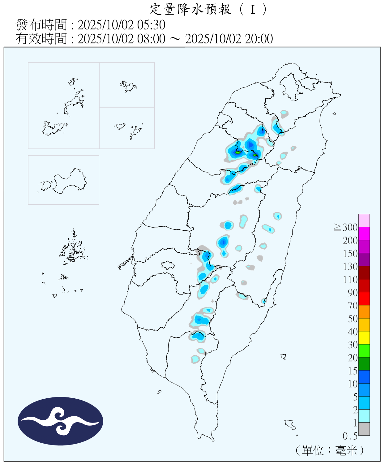
定量降水預報
主地圖(颱風/警戒/災情)
宜蘭縣
基隆市
臺北市
新北市
桃園市
新竹縣
苗栗縣
臺中市
彰化縣
南投縣
雲林縣
嘉義縣
臺南市
高雄市
屏東縣
臺東縣
花蓮縣
有效累積雨量排名(
全國
)
新豐
102 mm
外來吉
93 mm
太和村
82 mm
來吉國小
80 mm
六龜(4)
73 mm
衛星雲圖
