A Geomorphological Map, or landform map, is a cartographic product spanning the fields of geomorphology and cartography. It functions as a classification system that graphically records the distribution of 『landforms』, surface features, and near-surface geological materials.
Definition: Records the distribution of 『landforms』, surface features, and near-surface geological materials.
Nomenclature: Distinguished from general topographical maps, they are often translated as "Geomorphological Map" or "Landform Map" to prevent confusion.
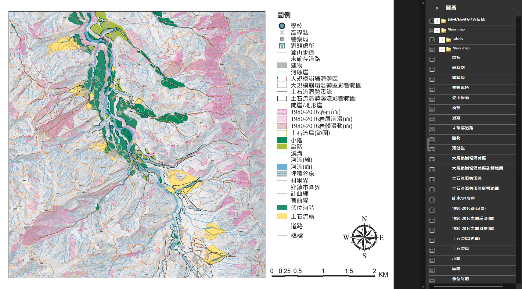
Illustration: Digitized map published in Geospatial PDF format. Image Source: Thematic Geomorphological Map Geospatial PDF of Large-Scale Collapse Potential Area - Lugu Sheet (2024).
International Development Overview
Geomorphological mapping originated in Europe in the mid-20th century, primarily to meet post-war land reconstruction needs. Countries including the UK, Germany, Poland, Italy, Japan, and Canada have all developed their own methodologies.
Origin: Mid-20th century in Europe, driven by post-World War II reconstruction demands.
Scaling: Employs multiple scales, often produced based on existing 『contour map』.
Standards: Production standards and map legends are flexible and adjusted according to national conditions.
Information Contained in Geomorphological Maps
The five main categories of information typically featured on geomorphological maps are crucial for understanding the evolution of landform units, the forces at play, and potential hazards.
L
Morphology
(morphology)
M
morphometry
(morphometry)
G
morphogenesis
(morphogenesis)
C
morphochronology
(morphochronology)
D
morphodynamics
(morphodynamics)
Application of Geomorphological Feature Maps in Natural Disaster Communication
Land surface morphology results from the interaction of geomorphic processes (forces), geological structure, and constituent materials within a specific environmental system, serving as a critical indicator for past and potential future disaster events.
Geomorphological features are tangible and visible, aiding readers in comprehending the characteristics of environmental changes.
Exquisite map design attracts readers and encourages them to explore the rich landscape information.
Integrating scientific research findings with local environmental knowledge and disaster memory facilitates effective community disaster preparedness communication.
Integrated Outcomes
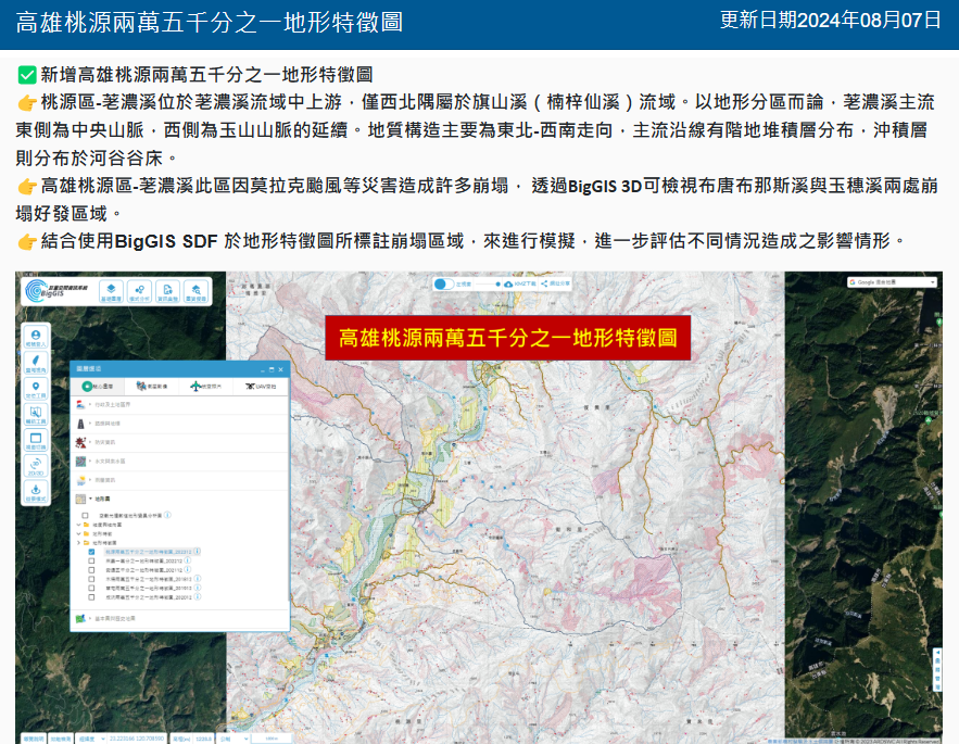
In collaboration with the Geomorphology Laboratory of the Department of Geography at National Taiwan Normal University and the National Science and Technology Center for Disaster Reduction (NCDR), we have completed the digitalization and systemic integration of multiple geomorphological maps. This work has made both historical and the latest topographic information available via the "Big Geospatial Information System (BigGIS)." These map resources provide specific morphological or locational terrain information, complementing 『contour map』s and 『hazard potential map』s. By allowing users to display multiple layers, the system enhances flexibility and accuracy for terrain analysis, disaster prevention and management, and planning applications.
Key Achievements
Completed the digitalization of geomorphological maps for the Muzha, Caotun, Chenggong, Antong, Laiyi, and Taoyuan sheets.
Established digital map tiles to provide specific morphological or locational information, offering an alternative reference beyond traditional topographical or 『hazard potential map』.
In the Big Geospatial Information System, multiple map layers can be displayed simultaneously, offering users a more diverse selection of map resources.
Illustration: Integration of Geomorphological Maps with the Big Data Geographic Information System. Image Source: Geomorphological Map Display Platform
Website Links
Rural Development and Disaster Management Agency Geospatial Big Data System
Provides query and application services for massive geospatial information related to topography, landslide, and soil and water conservation.
National Taiwan Normal University Department of Geography Geomorphology Lab, Geomorphological Feature Map Display Platform(https://atlas.geo.ntnu.edu.tw/)